Tides of Tadoussac.com Marées de Tadoussac
Search Results
92 résultats trouvés avec une recherche vide
- LE MIROIR Articles/Histoires | tidesoftadoussac1
LE MIROIR Stories/Histoires Le Miroir is published by the Municipality of Tadoussac, and they have asked for some photos and stories that illustrate the fascinating history of Tadoussac. As they come out they will be posted on this page in both languages! Le Miroir est publié par la Municipalité de Tadoussac et a demandé des photos et des histoires qui illustrent l'histoire fascinante de Tadoussac. À leur arrivée, ils seront affichés sur cette page dans les deux langues! UN PETIT PEIGNE CHEZ CID! Text from the book "Tides of Tadoussac" By R Lewis Evans Can you identify the people in this photo? In front of the door, Beth Dewart, Maggie Reilley, Geoff Izard, and at the right end MARIE CID POUVEZ-VOUS NOUS AIDER À IDENTIFIER LES PERSONNES SUR CETTE PHOTOS? À NOTER QUE MARIE CID SE TROUVE À L’EXTRÊME DROITE SUR LA PHOTO. We all know La Boheme in the middle of Tadoussac but some of us remember it fondly as the Marchand General du Pierre Cid. Pierre Cid was a Syrian who immigrated to Canada and settled in Tadoussac and after his death, three of his children, Joe, Marie, and Alexandrine ran the store right into their old age, living in the back of the building. Joe was a delightful man and ran the place. Marie, suffering from Parkinson's Disease, was small and shook constantly, but she was lovely to everyone, knew the price of everything in the store and could add in the tax in seconds. Alexandrine was quite the opposite. Not a believer in the idea that “the customer is always right,” she did not suffer fools gladly. Back in the days that the Canada Steamship Lines owned the Hotel Tadoussac the President of CSL came to stay at the hotel. The hotel staff were terrified. Criticism from the great man could cost them their jobs and they worked very hard to make sure everything was perfect. During his stay he decided to go play golf, and on his way there stopped his flashy big Cadillac outside the Marchand General. In he proudly walked in his canary yellow golfing outfit like a little Napoleon, looked at Alexandrine sternly, and said, “Je veux une peigne.” She made some grunt that sounded like a seal, shuffled off in her bedroom slippers into the gloom at the back of the store and returned with a used ice-cream bucket full of combs. He looked through them and said, “They're not very big, are they?” She looked him in the eye and replied in a voice that could be heard throughout the store, “Big enough for you. You don't have much hair anyway!” Tout le monde connait Le Café Bohème situé au coeur de Tadoussac, mais certains d’entre- nous s’en rappellent encore comme du Marchand Général Pierre Cid. Pierre Cid était un Syrien ayant immigré au Canada et qui s’était établi à Tadoussac. Après sa mort, trois de ses enfants, Joe, Marie et Alexandrine, ont pris la relève de la petite entreprise familiale jusqu’à leurs vieux jours, vivant dans la partie arrière du bâtiment. Joe était un homme charmant et était celui en charge du magasin. Marie, atteinte de la maladie de Parkinson, était petite et souffrait de tremblements constants. Elle était aimable avec tout le monde, connaissait les prix de tout ce qui se vendait en magasin et pouvait faire le calcul des taxes en quelques secondes seulement. Alexandrine était tout le contraire. N’adhérant pas à l’adage populaire voulant que le client aie toujours raison, elle n’avait que faire des imbéciles. Du temps où la Canada Steamship Lines était propriétaire de l’Hôtel Tadoussac, le président de la compagnie vint résider à l’Hôtel. Le personnel en était terrifié. Une mauvaise critique du grand patron pourrait leur coûter leur emploi et ils travaillèrent donc très fort afin de s’assurer que tout soit parfait. Lors de son séjour, monsieur le Président décida d’aller jouer au golf et en route, arrêta sa rutilante Cadillac devant le Marchand Général. Vêtu d’un habit de golf jaune canari, il entra dans le magasin d’un pas fier tel un petit Napoléon, adressa un regard sévère à Alexandrine et dit: « Je veux un peigne! ». Elle émit un petit grognement semblable à celui d’un phoque, trottina, pantoufles aux pieds, dans la pénombre de l’arrière-boutique et revint quelques instants plus tard avec un vieux pot de crème glacée rempli de peignes. Le Président y jeta un oeil et dit: «Ils ne sont pas très gros vos peignes.» Alexandrine le regarda droit dans les yeux et lui répondit d’une voix suffisamment forte pour être entendue à travers tout le magasin : «Ils sont bien assez gros pour vous. De toute façon, ce n’est pas comme si vous aviez beaucoup de cheveux !» Pierre Cid?
- Radford | tidesoftadoussac1
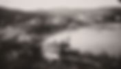
PREVIOUS Radford House Joseph Radford 1815-1885 and Isabelle White 1818-1902 NEXT PAGE Joseph Radford lived in Tadoussac during the 1800's until his death in Tadoussac in 1885. He worked at the saw mill in Anse a L'Eau, and held many positions including, postmaster, Custom's Agent, the first Manager of the Fish Hatchery (1874-85), and Mayor of Tadoussac. His wife was Isabelle White (1818-1902) and they had a daughter Belle (1845-1935). They built a house overlooking the bay at Anse a L'Eau. Joseph Radford habitait à Tadoussac dans les années 1800 jusqu'à sa mort à Tadoussac en 1885, il a travaillé à la scierie de l'Anse à l'Eau, et a occupé de nombreux postes, y compris, maître de poste, agent de mesure, le premier directeur de l'établissement piscicole (1874- 85), et Maire de Tadoussac. Sa femme était Isabelle White (1818-1902) et ils ont eu une fille Belle (1845-1935). Ils ont construit une maison avec vue sur la baie de l'Anse à l'Eau. Below, the house has scaffolding around it, being enlarged, about 1870's. NB: Look at the LAKE in these two photos, much smaller than today, probably before the dam was built. Ci-dessous, la maison est entourée par un échafaudage, étant élargie, environ 1870. NB: Regardez la LAC dans ces deux photos, beaucoup plus petite qu'aujourd'hui, probablement avant la construction du barrage. Radford House - late 1800's The view from the Radford House. The paddle-wheeler Thor at the dock in Anse a L'Eau. Le vapeur à aubes Thor au quai de l'Anse à l'Eau. After Mr Radford died, his family continued to live in the house for many years. His unmarried daughter Belle inherited the place and continued to live there until she was too old to manage it, whereupon she sold the house in 1918. The Radford House was used to put up overflow guests from Lady Price's cottage and, as those guests were mainly relatives and friends of her son, the young men home from the war, it became known as "the bachelor house". It was destroyed by fire in a strong Noroit in the winter of 1932. (thanks to Benny Beattie for some of the photos and text) Amazing what the internet will turn up, what follows is some paperwork that mentions Joseph Radford! Radford House Joseph Radford was one of the founders of the Tadoussac Protestant Chapel, and there's a window dedicated to him, as well as a plaque for his wife. Joseph Radford a été l'un des fondateurs de la Chapelle Protestante de Tadoussac, et il ya une fenêtre qui lui est dédié, ainsi que d'une plaque pour sa femme. Appointed Municipal Councillor of Tadoussac in 1869 Nommé conseiller municipal de Tadoussac en 1869 The letter welcomes Lord Dufferin, the Governor General, to Tadoussac in 1873. Joseph Radford was Mayor of Tadoussac. La lettre se félicite Lord Dufferin, Gouverneur Général, à Tadoussac en 1873. Joseph Radford a été Maire de Tadoussac. Après que M. Radford est décédé, sa famille a continué à vivre dans la maison pendant de nombreuses années. Sa fille non mariée Belle hérité de la place et a continué à y vivre jusqu'à ce qu'elle était trop vieux pour gérer, après quoi elle a vendu la maison en 1918. La Maison Radford a été utilisé pour mettre en place invités de débordement de la cottage de Lady Prix et, en tant que les clients sont principalement proches et amis de son fils, les jeunes hommes à domicile de la guerre, il est devenu connu comme «la maison de bachelier". Il a été détruit par un incendie dans une forte Noroit à l'hiver 1932. (grâce à Benny Beattie pour certaines des photos et du texte) Incroyable ce que l'Internet se retrouvera, ce qui suit est quelques papiers qui mentionne Joseph Radford! Details from the Department of Marine and Fisheries Radford's allowance for "Conducting Fish Breeding Establishment" for one year was $400 in 1877-1878 Détails du Ministère de la Marine et des Pêcheries L'allocation pour Radford pour "Mener l'établissement de la reproduction des poissons" pour une année était de 400 $ en 1877-1878 1881 Census shows Joseph Radford 66, his wife Isabella 62, daughter Bell 35, and his wife's sister Anna White 46. They were the only english family living full time in Tadoussac. (from Ancestry.com) Recensement de 1881 montre Joseph Radford 66, sa femme Isabella 62, la fille Belle 35, et la sœur de sa femme Anna Blanc 46. Ils étaient la seule famille anglaise vivant à temps plein à Tadoussac. (du Ancestry.com) Postmaster report by Joseph Radford in 1882 Rapport Postmaster par Joseph Radford en 1882 Postmaster report by Joseph Radford in 1882 Rapport Postmaster par Joseph Radford en 1882 Jos. Radford was paid $260 to be "Overseer" in 1884. Jos. Radford a été payé $ 260 pour être "Overseer" en 1884. Joseph Radford had many jobs! He was the Swedish and Norwegian Vice Consul at Tadoussac!? Joseph Radford avait de nombreux emplois! Il était le vice-consul de Suède et de Norvège à Tadoussac !? Joseph Radford 1815-1885 Good morning. I’m Tom Evans and I’m very interested in the history of our community and town, and I love these stories about the people who were here before us. We’ve heard about many of our ancestors and who’s related to who. But I’m going to talk about a guy who isn’t related to anybody we know, one of those names that you might see, on a window in this case, and wonder who he was You may have heard of my website of historic Tadoussac photographs, Tides of Tadoussac.com. I found I had several photographs of a big house in Anse a L’Eau that doesn’t exist anymore. It was large and square like Dufferin House, opposite the George Hotel, today there’s a yellow house and the parking lot we use when we go to the lake. It was called the Radford House, and I realized there was also a window in this church to Joseph Radford. Then I discovered that Benny Beattie had two pages in his book “Sands of Summer”about Joseph Radford, so that made the research much easier! We don’t know anything about his early life, but we can assume he came from England! Joseph Radford came to Tadoussac in the 1840’s, and lived in Tadoussac with a wife and daughter for his entire life, the only anglophone full-time residents of the town at that time. So Al and Jane you see you aren’t the first! His wife was Isabella White, and her plaque is there beside the window. He was a significant guy in the early days of the town of Tadoussac and had many many different jobs. He originally came to work in the Price Sawmill in Anse a L’Eau, and in 1848 William Price closed the mill, and Radford became the Manager, in a caretaker role and occasionally to operate the mill when enough wood had been harvested. In 1874 the old mill was ceded to the Federal Ministry of Marine Fisheries for $1, and Radford directed the renovation of the old building for its new role, and managed the fish hatchery for the next 11 years. In 1878 he was paid $400 for “conducting a Fish Breeding establishment”, and they would raise and release up to a million small salmon a year in the area rivers. He was known as the last Factor of the Hudson’s Bay Post, which was in front of the Hotel Tadoussac when it was first built, until the Post was demolished about 1870. He was also listed as the Postmaster, Protection Officer, and Custom’s Agent. He was the Swedish and Norwegian Vice Consul at Tadoussac!? Not sure what that job entailed! He was part of a group that included names like Rhodes, Russell, and Urquhart that formed a company to build the first Tadoussac Hotel in 1864. And he was one of the founders of the Tadoussac Protestant Chapel in 1866. In 1863 he bought the land opposite the Hotel Georges from David Price, and demolished the house that was there and build a magnificent white house overlooking the old Salmon Pool and the cove. Early photos of Anse a L’Eau feature two imposing buildings above the wharf and mill, The Georges and the Radford House. In 1873 there was excitement in Tadoussac, Lord Dufferin was coming to build a house and become a summer resident. Joseph Radford had been a town councillor and by this time was the Mayor of Tadoussac! He and the other important people in town at the time wrote a flowery letter of welcome, in which they explain that they could not possibly afford to provide a welcoming reception, being such a small community, but “hope that we may have the pleasure during many future seasons of seeing your Excellencies and your amiable family at our beautiful little seaside village”. Joseph Radford died in Tadoussac in 1885 at the age of 70, and his family continued to live in the house for many years. His unmarried daughter Belle inherited the place and lived there until she was too old to manage it, whereupon she sold the house to Lady Price in 1918, Belle went to live in Montreal but continued to spend her summers in Tadoussac, staying at the Desmeules boarding house across the street, now known as the Hotel Georges. Ainslie Stephen says she remembers going to visit Belle with her mother, Dorsh. Belle died in 1935. The Radford house was used to put up overflow guests from Lady Price’s cottage, and as these guests were mainly relatives and friends of her son, young men home from the First World War, it became known as the “bachelor house”. It was destroyed by fire in a strong Noroua storm in the winter of 1932. Anyway the window says “in loving remembrance of Joseph Radford” so it’s nice to have some idea of who he was! NEXT PAGE
- EVANS | tidesoftadoussac1
PREVIOUS EVANS Arrival in Canada NEXT PAGE This page is about My great-grandfather Francis Evans 1801-1858, who came to Canada from Ireland with his wife Maria Lewis in 1842. They had 12 children, and lived near Simcoe in southern Ontario. Their 11th child was Thomas Frye Lewis Evans 1846-1919, my grandfather, who spent many summers in Tadoussac (see next page). According two other people's research, we are descended from a Welsh Prince of 1000 years ago, and two brothers who moved from Wales to Ireland in the 1400's. Francis Evans 1803-1858 The Evans family house in Ireland The Evans family house is in the middle of Ireland! From the Dictionary of Canadian Biography (slightly abridged) EVANS, FRANCIS, Church of England clergyman and educator; b. 1 Jan. 1801 in Lough Park, an estate near Castlepollard, County Westmeath (Republic of Ireland), son of Francis Evans; m. c. 1825 Maria Sophia Lewis, and they had six sons and six daughters; d. September 1858 in County Westmeath, and was buried in Castlepollard. Francis Evans, a graduate of Trinity College, Dublin, arrived in Lower Canada in 1824, intent on entering the Anglican ministry. His decision to emigrate may have been influenced by the presence in the Canadas of his uncle, Thomas Evans , a soldier. Shortly after arriving he went back to Europe to marry, and then returned to the colony. On 11 Nov. 1826 he became a deacon, was appointed curate two days later to the Reverend Robert Quirk Short at Trois-Rivières, and was ordained priest on 27 Oct. 1827 by Bishop Charles James Stewart . Evans did well at Trois-Rivières, reporting in 1827 that his congregation had grown by one-third since his arrival even though there had been no increase in population. Nevertheless, he accepted a missionary posting to Upper Canada sponsored by the Society for the Propagation of the Gospel. In October 1828 he took his young, growing family to Norfolk County where St John’s, near the village of Simcoe in Woodhouse Township, became his home church. He was the first Anglican clergyman to settle in Woodhouse, even though his parishioners, largely United Empire Loyalists and their descendants, had built the church some years before in anticipation of a permanent appointment. Like most Anglican clerics, Evans concentrated his efforts by ministering regularly to a few settled charges. He attempted, however, to preach occasionally in “every place that it is in my power to visit.” He found his labours well received. In 1830 he reflected, “It is particularly gratifying to perceive that the prejudices against our Establishment which were very prevalent are disappearing most rapidly.” None the less, the privileged position of the Church of England ensured it and its servants a host of enemies. William Lyon Mackenzie , for one, twice publicly portrayed Evans as unfeeling and uncaring, characteristics allegedly typical of Anglican clergymen. In 1836 Evans found himself in the public eye again when Lieutenant Governor Sir John Colborne responded to the critics of the church’s claims to establishment by endowing 44 Anglican rectories, one of which went to Evans. The rectories, and Anglican pretensions generally, certainly helped bring about the Upper Canadian rebellion, which affected Evans dramatically. In December 1837 Charles Duncombe and Eliakim Malcolm, responding to rumours that rebels had taken Toronto, mustered some 400 to 500 insurgents southwest of Brantford. On the night of 12 December Evans led a little loyalist band bearing messages through rebel lines to Brantford. The next day the rector bravely went to the insurgent camp “to expostulate,” as a fellow priest recorded, “with the deluded schismatics.” Evans brought news of the governor’s proclamation promising pardon for those returning peacefully home. For his efforts, he was detained. Fortunately, release came soon when the rebels dispersed upon discovering that Mackenzie had been defeated in Toronto and that forces, led by Allan Napier MacNab , were marching against them. But Evans could not escape controversy. In the trials that followed he testified against several prominent insurrectionists, thereby earning further ill will. On 2 Oct. 1838 a mob occupied the Congregational church in Burford Township to prevent his preaching there. Eventually the clamour faded, and Evans settled back into an all too penurious routine. As was the custom with other clerics he had to supplement his meagre income by teaching. He first operated a boarding-school and began teaching at the district grammar school in Simcoe when it opened in 1839. As a teacher he took special interest in aspiring clergymen. He also laboured earnestly at his regular pastoral duties, establishing some 14 congregations in the surrounding district. He toiled for the Upper Canada Bible Society and spread the temperance message. At the time of his death he was an archdeacon and rural dean of Norfolk County. These toils exhausted Evans. In 1855 Bishop John Strachan , who thought him “an active and zealous Missionary,” warned him that a continuance of his “usual labours” would be too much for him, and he was right. In a futile effort to recover his health Evans holidayed in Ireland in 1858 but died there between 5 and 7 September after spending only a week with a brother and sister. In Canada he left a monument of solid if unspectacular work and a large, well-educated family. Colin Frederick Read AND let's not forget his wife, Maria Sophia Lewis, who probably had a lot to do with the large, well-educated and successful family! She was b orn in Martock, Somerset, England on 1804 to Thomas Fry Lewis and Charlotte Georgina Forter. She passed away on 29 Jul 1881 in (interestingly) Québec City. St. John's Church, Woodhouse, just south of Simcoe Ontario #6 "Another son b 1845" is Thomas Frye Lewis Evans, the Dean who ended up in Tadoussac!>> This document at left was created in the 1950's, and has lots of information about the Evans and Lewis families and descendants. Several excerpts have been shown above if you don't want to read the whole thing! (The document at left is 38 pages and it's a pdf so you can read it - I made page 35!) NEXT PAGE
- Minnie Rhodes & Harry Morewood | tidesoftadoussac1
Mary Elizabeth (Minnie) Rhodes 1857-1942 & Henry Francis (Harry) Morewood 1855-1916 NEXT PAGE PREVIOUS This page under construction
- HOUSES | tidesoftadoussac1
PREVIOUS Houses NEXT PAGE Select from the pull-down menu above Sélectionnez dans le menu déroulant ci-dessus Many more to come...
- Sports | tidesoftadoussac1
Été à Tadoussac Summer 1920-1940 Page 6 of 7 PREVIOUS NEXT PAGE Sports Sports 1931 An exciting 30's sport, with over 70 in the audience Un sport passionnant, avec plus de 70 dans le public 1930's Tennis at the Tadoussac Tennis Club, already 25 years old! Elliott Turcot Betty Morewood (Evans) ? Phoebe Evans (Skutezky) Tennis à Club de Tennis Tadoussac, déjà 25 ans! Back Jack Wallace, Phoebe Evans (Skutezky), ?, Susie Russell, Frances Holland, Elliott Turcot, Bill Morewood Front Trevor Evans, ?, ?, Betty Morewood (Evans), Ainslie Evans (Stephen) Right Michael Wallace, Bill Morewood, Elliott Turcot, Ainslie Evans (Stephen) 1930's Jim Alexander at right Left 1930's Ann Stevenson (Dewart) Helen Neilson WHAT are they doing? Flying a kite with a CLOCK attached? Jim Warburton Jack Wallace Lennox Williams Que font-ils? Un cerf-volant avec une horloge attachée? Ping Pong Gertrude (Williams) Alexander and Lennox Williams Jim Alexander 1930's Going Fishing Nan (Rhodes) Williams Jack Wallace Ron Alexander Sr Jim Alexander 1930's Golf Phoebe Evans (Skutezky) Susie Russell Betty Morewood (Evans) Ainslie Evans (Stephen) 1930's Golf Phoebe Evans (Skutezky) Susie Russell Betty Morewood (Evans) Ainslie Evans (Stephen) 1930's Golf Above Lennox Williams Left Margaret Morewood Bill Morewoodl Betty Morewood (Evans) Bobby Morewood PREVIOUS NEXT PAGE
- 1950's | tidesoftadoussac1
PREVIOUS Images of the 1950's NEXT PAGE Many of these photos come from our family slides, taken by Lewis Evans, as well as contributions from other family albums. Many picnics and boat trips, that's when photos were taken! These people you may know! Plusieurs de ces photos proviennent de nos lames de famille, prises par Lewis Evans, ainsi que des contributions d'autres albums de famille. Pique-niques et des excursions en bateau beaucoup, c'est là que les photos ont été prises! Ces personnes que vous connaissez peut-être! In our family the 50's started with a new (old) boat. The Noroua (below) which Dad had bought as a bachelor in the 30's was not a family boat, so he sold it and found this Lower St Lawrence Yawl, probably built about 1900. In the photo above are probably Lew and Anne (bottom right) and Capt Dallaire telling stories. Dans notre famille, les années 50 ont commencé avec un nouveau (vieux) bateau. Le Noroua (ci-dessous) qui papa avait acheté en tant que célibataire dans les années 30 n'était pas un bateau de famille, donc il l'a vendu et il a trouvé ce Bas-St-Laurent Yole, probablement construit vers 1900. Sur la photo ci-dessus sont probablement Lew et Anne (en bas à droite ) et Capt Dallaire raconter des histoires. July 1951 The two boats were together in Tadoussac briefly, and then Dad took the Noroua up river to the buyer in Ottawa. His crew included John Price, our cousin and frequent visitor to Tadoussac. Les deux bateaux étaient ensemble à Tadoussac brièvement, puis papa a pris la Noroua sur le St-Laurent à l'acheteur, à Ottawa. Son équipage comprenait John Price, notre cousin et visiteur fréquent à Tadoussac. Above, Anne, Lewis, and Tom (that's me!), and our mother Betty Evans. At right, Doris Molson. Below, Ernie and Phoebe Skutezky. Guy Smith and the Hobo Below, anchored up the Saguenay with the Bonne Chance, dumping water out of a nor-shore canoe on the deck. Ci-dessous, ancré sur le Saguenay avec la Bonne Chance, vider l'eau d'un canot sur le pont. Horse-drawn picnic at Moulin Baude, Russell Dewart, Elizabeth O'Neill, Ann Dewart and their kids Pique-nique tiré par un cheval au Moulin Baude, Russell Dewart, Elizabeth O'Neill, Ann Dewart et leurs enfants Left, Hector Gauthier, Lewis and Anne, and the Parker Brothers, and Marcel. Below right John and Jean Aylan-Parker and the boys, Ted, Ron and Jim. Below left Mary Wallace talking to Hector Gauthier, Bishop Lennox Williams. In the hotel pool Teddy Parker, Michael Reilly, Teddy Dewart Seeing people off on the CSL boat. Aylan-Parker family on the left. Dire au revoir aux gens sur le bateau de CSL. Famille Aylan-Parker sur la gauche. The Dewart family Tom (with the girls) Cathy O'Neill, ?, Beth and Judy Dewart, Cathy and Bar Campbell Tom avec les filles! Need some help with names! Kids are Susie Scott, Aiden O'Neill, Bobby Scott, Cathy and Patrick O'Neill. Grace Scott on the right, beside her is Elizabeth O'Neill. Lilybell Rhodes at Spruce Cliff On the Bonne Chance Left, Michael Leggat with Tom and Alan Evans Below John and Robbie Leggat with Lewis Evans and Mum (Betty Evans) on the right Nan and Bob Leggat Picnics at the Flat Rocks From left (best guesses) Jean Parker, me?, Betty Evans, ???, Ainslie Stephen with her kids, Anne Evans, three Parker boys at the back, Bob and Nan Leggat with ?, Anita was a babysitter with ? Sally Price, Anne Evans, Margie Stephen Bill Stephen Lewis Evans Robbie Leggat John Leggat John Turcot Anne and John Price on the Bonne Chance Tom, and Alan>> Tom>> The end of the season, Hobo entering the drydock. Probably Armand Imbeau sitting on the gate, and Smith girls and others watching from the rocks. Below seeing people off on the CSL boat. La fin de la saison, Hobo entre la cale sèche. Probablement Armand Imbeau assis sur la porte, et les filles Smith et d'autres regarder le spectacle . Ci-dessous, dire au revoir aux gens sur le bateau de CSL. This video was taken by Jack Wallace in about 1962 at the Tadoussac Tennis Club, thanks to Mike Leggat for sharing and getting me to watch it! There's hours and hours... Faces I saw David Turcot John Leggat Robbie Leggat Deborah Wallace Armitage Judy Stairs John Turcot Judith Dewart Stinson Beth Dewart Marg Wallace Sue Stairs Barbara Campbell Nan Leggat John Price Teddy Aylan-Parker Mary Wallace and at the end Will Leggat and Catherine Williams(isn't she cute)! others? NEXT PAGE
- Colour! | tidesoftadoussac1
Photos Historique Tadoussac 1860-1900 Tadoussac The oldest Photographs Les plus anciennes Photographies Photography was invented about 1839, and Tadoussac was a popular subject for well-know professional photographers such as William Notman (father and son) and Livernois from the 1860's. This page is a collection of the early photos, before personal cameras were invented (the first Kodak camera was 1888). The 1860's was a busy time in Tadoussac. The first summer residences were built in the early 1860's. The Tadoussac Hotel, the future Cid store, and the row of 5 houses on the main street were built in 1864. The Protestant Chapel was built in 1867. The old Hudson's Bay Post was on the lawn in front of the Hotel until 1870, which helps with figuring out the dates of the photos! Notice most of the trees have been cut all around Tadoussac! DATES may not be exact, a list of key dates may be found at the bottom of the CONTENTS page (please send dates!) https://www.tidesoftadoussac.com Thanks to McCord Museum, Hotel Tadoussac, BAnQ, and everyone who collects and loves old photographs! La photographie a été inventée vers 1839 et Tadoussac était un sujet prisé par des photographes professionnels reconnus tels que William Notman (père et fils) et Livernois dès les années 1860. Cette page est une collection des premières photos, avant l'invention des appareils photo personnels (le premier appareil photo Kodak date de 1888). Les années 1860 furent une période occupée à Tadoussac. Les premières résidences d'été ont été construites au début des années 1860. L'Hôtel Tadoussac, le futur magasin Cid, et la rangée de 5 maisons sur la rue principale ont été construits en 1864. La Chapelle protestante a été construite en 1867. L'ancien Poste de la Baie d'Hudson était sur la pelouse devant l'Hôtel jusqu'en 1870, ce qui aide à déterminer les dates des photos ! Remarquez que la plupart des arbres ont été coupés tout autour de Tadoussac! Les DATES peuvent ne pas être exactes, une liste des dates clés peut être trouvée au bas de la page CONTENU (veuillez envoyer les dates!) https://www.tidesoftadoussac.com Merci au Musée McCord, à l'Hôtel Tadoussac, à BAnQ et à tous ceux qui collectionnent et aiment les photographies anciennes ! 1860-1900 Maybe before the Hotel was built? Peut-être avant la construction de l'hôtel ? Powel/Bailey House <<<Hanging Beach Cote Ida Hovington Stairs Rectory Evans/Beattie Houses on the beach and a boat being built House on Main Street (right side, now Auberge Galouine) Still 1860's Maisons sur la plage et un bateau en construction Maison sur la rue Main (côté droit, maintenant Auberge Galouine) Toujours des années 1860 One more house on the beach! Une maison de plus sur la plage ! Chapelle de Tadoussac - rectangular windows were replaced with nicer windows, there doesn't seem to be a graveyard yet, still 1860's Chapelle de Tadoussac - les fenêtres rectangulaires ont été remplacées par de plus belles fenêtres, il ne semble pas encore y avoir de cimetière, toujours des années 1860 In the 1860's the Price Sawmill at Anse à L'Eau had been closed for more than 10 years. Below is a 'colourized' photo. Many other photos of Anse à L'Eau at https://www.tidesoftadoussac.com/anse-a-l-eau Dans les années 1860, la scierie Price à l'Anse à l'Eau était fermée depuis plus de 10 ans. Ci-dessous une photo "colorisée". Beaucoup d'autres photos de l'Anse à L'Eau à https://www.tidesoftadoussac.com/anse-a-l-eau CIrca 1860's, the future George Hotel, some new houses, and the Radford House. The lake is much smaller than today, many years before a dam was built. Vers les années 1860, le futur George Hotel, quelques nouvelles maisons et la Radford House. Le lac est beaucoup plus petit qu'aujourd'hui, bien des années avant la construction d'un barrage. The BRIDGE over the ravine is very interesting. Le PONT sur le ravin est très intéressant. A peine étions-nous montés dans la voiture de l'hôtel que nous nous trouvions en train de traverser au grand galop un pont de planches branlant. Les vieilles dames hurlaient de frayeur, tandis que notre Jean, d'une voix tonitruante, nous criait : « Il fait très noir ce soir, si vous voyez où vous êtes, vous faites peur ! Évidemment, ce cocher distingué qui arborait avec tant de désinvolture son vieux manteau miteux devait être natif de l'endroit. Dufferin House (left) was built in 1873 La maison Dufferin (à gauche) a été construite en 1873 circa 1880's some houses have been built on Pointe d'Islet Below a close-up of one of the houses vers 1880 quelques maisons ont été construites sur la Pointe d'Islet Ci-dessous un gros plan d'une des maisons Circa 1880's, my ancestors on the lawn of the Rhodes cottage, many more photos on another page https://www.tidesoftadoussac.com/rhodes-cottage-1 This photo is on a glass plate, there are some cracks and some pieces missing! My G-G-Grandmother Anne Dunn Rhodes in black, and William Rhodes is in the third photo, the only man! Also a baby carriage! Circa 1880's, mes ancêtres sur la pelouse du cottage Rhodes, beaucoup plus de photos sur une autre page https://www.tidesoftadoussac.com/rhodes-cottage-1 Cette photo est sur une plaque de verre, il y a quelques craquelures et quelques morceaux manquants ! Ma G-G-Grand-mère Anne Dunn Rhodes en noir. William Rhodes est sur la troisième photo, le seul homme ! Aussi un landau! Late 1800' s, the Mill has become a Fish Hatchery, and the dock is used for the Steamers, which was the primary method of transportation to Tadoussac. À la fin des années 1800, le moulin est devenu une écloserie et le quai est utilisé pour les bateaux à vapeur, qui étaient le principal moyen de transport vers Tadoussac. Église de la Sainte-Croix built 1885-9, and the hotel was expanded circa 1900, so this is 1890's. Above the main street is an empty sand dune! L'église de la Sainte-Croix a été construite de 1885 à 1889, et l'hôtel a été agrandi vers 1900, nous sommes donc dans les années 1890. Au-dessus de la rue principale se trouve une dune de sable vide ! Anse à L'Eau is still the only dock in Tadoussac, with a new pavilion. L'Anse à L'Eau est toujours le seul quai à Tadoussac, avec un nouveau pavillon. 76
- Museum | tidesoftadoussac1
Bonne Chance in the Barn/Molson Museum Molson Museum and the "Bonne Chance" This is a crazy part of my family history in Tadoussac! My father, Lewis Evans, loved old wooden boats, and in 1951 he bought an old Lower St Lawrence Yawl and named it the "Bonne Chance". It was built about 1870 on Ile D'Orleans. This was our boat until 1966, when it was bought by Jack Molson and James Beattie, and installed in a barn built by Pierre Tremblay near the lake in Tadoussac, where it remains preserved today. The barns contain a vast collection of artifacts collected over 50 years ago, and now part of The Canadian Heritage of Quebec. In recent years they have held an open house in August to give the public a chance to see the collection. Pierre Tremblay built several houses in Tadoussac. He worked primarily for the English-speaking community, maintaining their cottages; Hector Gauthier trained him for this work. He built the old barns behind the Maritime Museum, erected the Jacques Cartier Cross, and carried out repairs to the Chauvin House and the Old Chapel in the 1960s. After his death in 1991, Roger and Jean-Philippe Hovington took over from the summer residents. LES VIEILLES FAMILLES DE TADOUSSAC, 1850-1950 Gaby Villeneuve Pierre a bâti plusieurs maisons à Tadoussac. Il a principalement travaillé pour la communauté anglophone, entretenant leurs chalets ; Hector Gauthier l'a formé à ce travail. Il a construit les vieilles granges derrière le Musée maritime, érigé la croix Jacques-Cartier et effectué des réparations à la maison Chauvin et à la vieille chapelle dans les années 1960. Après son décès en 1991, Roger et Jean-Philippe Hovington ont pris la relève des résidents estivaux. Ceci est une partie folle de l'histoire de ma famille à Tadoussac! Mon père, Lewis Evans, aimait vieux bateaux en bois, et en 1951, il a acheté un vieux Bas-Saint-Laurent Yawl et nommé le "Bonne Chance". Il a été construit vers 1870 sur l'Ile d'Orléans. Ce fut notre bateau jusqu'en 1966, quand elle a été achetée par Jack Molson et James Beattie, et installé dans une grange construite par Pierre Tremblay près du lac à Tadoussac, où il reste aujourd'hui conservé. Les granges contiennent une vaste collection d'artefacts recueillis il y a plus de 50 ans, et fait maintenant partie de l'Héritage canadien du Québec. Au cours des dernières années, ils ont tenu une journée portes ouvertes en Août pour donner une chance de voir la collection au public. The Yawl in the beach in Tadoussac in 1950, with Capt Edgar Dallaire (the tall man) probably talking about boats! My brother and sister in the foreground, probably not understanding. La Yole dans la plage de Tadoussac en 1950, avec le capitaine Edgar Dallaire (le homme de grande taille) parle probablement de bateaux! Mon frère et soeur au premier plan, probablement pas comprendre. I could stand up in the cabin when I was small, but with 4'6" headroom it got much smaller as I grew up! Je pourrais tenir debout dans la cabine quand j'étais petit, mais avec 4'6" espace libre il eu beaucoup plus petite que j'ai grandi! Heading up the Saguenay circa 1960 on the "Bonne Chance", Lewis Evans and his 3 sons, Alan, Tom and Lew Jr., and the dog Jeff. En remontant le Saguenay vers 1960 sur la "Bonne Chance", Lewis Evans et ses 3 fils, Alan, Tom et Lew Jr., et le chien Jeff. D.F.T. & T.F.D. The "White Boat" above circa 1910, below circa 1960, and at right today in the Museum. Le "White Boat" ci-dessus vers 1910, ci-dessous vers 1960, et à droite aujourd'hui au musée. 32
- R Lewis Evans & Betty Morewood Evans | tidesoftadoussac1
PREVIOUS R Lewis Evans 1911-1988 Betty Morewood Evans 1922-1993 NEXT PAGE Circa 1900 Tadoussac Dad's family before he was born, Dean Lewis Evans (sitting), his first wife May, his 4 children Basil, Trevor (with pipe), Muriel and Ruby. On May 7th, 1911, Emily Elizabeth (Bethune) Evans, at age 46, gave birth to her first and only child, Robert Lewis Evans. Her husband, the Reverend Dean Thomas Frye Lewis Evans, was 67 and the father of four adult children and already a grandfather. So baby Lewis entered this world with a readymade niece and nephew, and only nine years to get to know his father. Born in 1911, RLE held by his nephew Miles who was older than he was. RLE with his mother, Emily (Bethune) Evans RLE at Cap a Jack with his Dad Doris Molson and RLE on the beach in Tadoussac Dean Lewis Evans and his (second) family Miles Hudspeth and RLE on the beach in Tadoussac RLE with half-brothers Basil and Trevor Evans, about 1914 RLE with half-brother Trevor Evans, about 1916 RLE with friend Ralph Collyer Dad always loved this photo, with his friend Marjorique sailing a model of a lower-St Lawrence Yawl. Later he owned a boat almost exactly like this one, called the Bonne Chance. There he is, sailing with the dog Fancy. RLE and his dog at the cottage in Tadoussac RLE with his mother, and in a photo by Notman Above, RLE with his half-brothers Basil and Trevor, and father Dean Lewis Evans (Dean of Montreal), at the cottage in Tadoussac. At right on the same day, mother Emily, Kae, Miles and Muriel have joined in. St Stephen's Rectory in Montreal RLE beside Ann Dewart at Cap a Jack RLE worked at a camp at Bon Echo, lots of sailing and building props circa 1930 RLE combining his interest in boats and stage sets! He seems to have mocked up an enormous miniature CSL boat and launched it! Lots of boats! The raft above wouldn't work in the Saguenay, probably above the dam at Moulin Baude, with Harry Dawson, cousin No complaints! RLE on a BOAT with 7 girls Below with the older crowd, tea at Pte a la Croix! Camping at Petit Bergeronnes above, and at Cape Eternity, probably by rowing in a nor-shore canoe Betty Morewood age about 16? on the Saguenay. It looks like Trevor Evans and Bill Morewood in the canoe. This photo was in RLE's photo album from the late 1930's, he married Betty in 1944. Late 1930's, RLE bought a small schooner built in Tancook Island, Nova Scotia, called it the Noroua The Tadoussac gang on the wharf circa 1939, l to r (Mickey) Ainslie Evans (Stephen), Mary Fowler, Marion Strong, Bill Morewood, Barbara Hampson (Alexander/Campbell), Jim Alexander (sitting), Teddy Price, Mary Hampson (Price), Evan Price, Jim Warburton, Jack Wallace, John Turcot RLE taught at Bishop's College School from 1933-1972. Above the only time I've ever seen him on skates much less in hockey gear. Notables include Graham Patriquin, Headmaster Grier, Oggy Glass, and RLE on the right. Mid-1930's, RLE is the coach, and on the team is EM Fisher, son of Evelyn (Meredith) Fisher, she is widow of Jim Williams (died in WW1, see his page). EM Fisher died in 2012. Small world in those days, they were definitely aware of the Tadoussac connection. RLE was a keen skier, coached the ski team at BCS. He broke his right arm badly in the 1930's, and this restricted movement meant he couldn't hold a gun properly (or salute) and it prevented him from serving in WW2. I didn't know about the cool car RLE owned until I went through these albums! He took it to Tadoussac in the winter in the 1939, left, "on the road between Cap a L'Aigle and St Simeon". Above on a sketchy ferry near Portneuf. Left in front of the Prep school at BCS. Below RLE teaching a class! RLE did this drawing of the Noroua and sent it to his future in-laws, the Morewoods, for a Christmas card - what could anyone want more than a picture of his boat! Betty (Morewood) Evans and R Lewis Evans on the beach in Tadoussac circa 1945? married but before kids? 1951 - the Noroua and the Bonne Chance together briefly at the wharf in Tadoussac. The Noroua was sold to someone in Ottawa, shown below on the delivery trip up the river, with John Price one of the crew. (Note I was born on July 4 1951 so I was probably a week or 2 old at this time! I made it to Tadoussac at the end of July, so I'm told) Mum and Dad in 1961 Us kids on a trip to Tad about 1963 Lewis, Tom, Alan, Anne. Lewis Evans in a Tadoussac with Betty 1961 at his desk in the Common Room at BCS and directing a play and all summer on the Saguenay The family in 1975 Back - Lew & Cathy, Alan, Heather, Tom and Rocky Front - Anne, Pauline Belton, Dad & Mum, Ian Kids - Carrie and Ian Belton Wedding of Tom and Heather 1976 Gord, Wilf, Heather, Joan, Gail (all Smiths) Heather, Hank Law, Tom, Suzanne Skolnick Mum, Dad, Alan, Anne, Cathy Kids - Ian and Carrie Belton NEXT PAGE about 1987 in Tadoussac Mum & Dad, Heather and I, and our kids Julia and Sarah R Lewis Evans died in 1988 at the age of 78. This biography is quite random, driven by the photographs that are available. Thus there's a lot missing, and many photos of boats! To be continued... On May 7th, 1911, Emily Elizabeth (Bethune) Evans, at age 46, gave birth to her first and only child, Robert Lewis Evans. Her husband, the Reverend Dean Thomas Frye Lewis Evans, was 67 and the father of five adult children and already a grandfather. So baby Lewis entered this world with a readymade niece and nephew, and only nine years to get to know his father. On October 19th, 1922, Caroline Annie (Rhodes) Morewood, at age 42, gave birth to her second child, Elizabeth Anne (Betty) Morewood. Her husband was her first cousin, Francis Edmund Morewood, who was 5 years her junior. Twenty months earlier, Carrie and Frank had produced a son, William Harold Morewood. On August 5th, 1944, at the Coupe in Tadoussac, 33-year-old Lewis asked 21-one-year-old Betty to marry him. She said yes, and their lives came together on December 27th of that year. Until the Dean died in 1920, the Evans family had spent their winters in Montreal and every summer in their house in Tadoussac, which at that time was the farthest east Price brothers house, later sold to the Beatties. After his death, however, mother and son moved to Toronto for the winter, but still got to Tadoussac each year. Emily must have been concerned that her son should have male role models in his life, so she had him attend Trinity College School – a boys boarding school in Port Hope, ON. Lewis liked the school and had positive memories of it. This is remarkable because on a personal level, these were difficult years. At the age of 14, he was hit by a severe case of alopecia, an autoimmune disorder whereby one’s hair falls out, and over the next year or so, he lost all his hair. When asked how Lewis handled this in an often unsympathetic boarding school environment, one of his classmates said that such was his quick wit that any boy who set out to tease him was swiftly put in his place. Between graduating from TCS and starting at Trinity College in Toronto, Lewis was taken on a European tour by his mother. They travelled extensively and visited many specialists in an effort to reverse the effects of alopecia. The tour was wonderful, the hair did not come back, and perhaps worst of all, they missed their summer in Tadoussac. This was the only summer Lewis missed in his 77 years. It was after this tour that Lewis chose to wear a wig, a decision he frequently regretted especially in the heat of the summer. Meanwhile, Betty, one of Col. William Rhodes’s many great-grandchildren, was growing up in Doylestown, Pennsylvania. She attended the Baldwin School for girls and subsequently Bryn Mawr and University of Pennsylvania. Her family would spend time in Tadoussac most summers, renting rooms in Catelier House (now the Maison du Tourisme) but then, in 1936, her father designed and built a house, now called Windward. From then on, she never missed a summer visit. In 1948, Frank Morewood sold Windward to Betty and Lewis for $1, and suddenly, Lewis, whose mother had died the year before, found himself with two cottages in Tadoussac. He chose to keep Windward, partly because it was newer, partly because it was politic, partly because of its view, but especially because he could see his boat at its buoy in the bay! At university, Lewis had studied English, graduating in 1933, and Betty had majored in business, graduating in 1944. Lewis followed through on his plan to be a teacher, receiving offers from a school in Bermuda and one in Lennoxville. Because Lennoxville was closer to Tadoussac, he started his career in 1934 at Bishop’s College School from which he retired in 1972. He did take a year away to get his teaching credential at University of London where he was delighted to have a front-row seat for the abdication of King Edward VIII and was on the very crowded street watching the parade leading to the coronation of George VI. Any career plans Betty had upon graduation were trumped by her summer engagement and winter wedding... and in the fullness of time, by the arrival of Anne, Lewis, Tom and Alan. She was of the generation when women were mothers and homemakers, and to these functions, Betty added the role of steadfast supporter of all that her husband did, and BCS benefitted from her unpaid and often unknown contribution. For the first 18 years of their marriage, Lewis was a Housemaster. Betty knew all the boys and welcomed them into her home as a matter of course. Every teacher new to BCS was invited to Sunday dinner, and she frequently found herself hosting parties for faculty and friends. She has been called a world-class knitter and a world-class worrier (especially about her children no matter how old they were). Meanwhile, Lewis, who had moved to the Upper School after five years teaching in the Prep, was completely immersed in the life of the school – teaching, coaching, directing plays and running his residences. He was one of the pioneers of ski racing in the Eastern Townships, and spent many hours freezing at the bottom of a hill, clipboard in one hand and stop watch in the other. He was an example of service and character. When he died, one Old Boy remembered him as “an oasis of calm in an otherwise harsh and demanding school.” Indeed, he was. But his contributions went beyond BCS. From the mid-50s until his retirement in 1972, he spearheaded the Lennoxville Players, directing many plays from British farces to Broadway musicals. This was a group of amateur “actors” from all levels of the community who were, like their leader, looking for an enjoyable night out... and all proceeds to go to a local charity. In 1972, Betty and Lewis retired to Brockville, Ontario. Here, they joined Tadoussac friends, Rae and Coosie Price and Jean and Guy Smith who had already retired to this comfortable town on the eastern end of the Thousand Islands. From there, they travelled to Tadoussac – for many years by boat, almost 700 kilometers down the St. Lawrence in their cabin cruiser, Anne of/de Tadoussac. For all their lives, home was where the family was, but Tadoussac was where the family was at home. The village, the river, the tides, the mountains, the beaches, the people, all had a strong hold on their hearts. In late spring, the family would leave Lennoxville before dawn on the first morning after the last teachers’ meeting, and at the end of the summer, they would return the day before the first meeting for the coming school year. After retirement, the summer would extend from the May long weekend until Thanksgiving. An accomplished sailor and boatman, Lewis knew every cove and anchorage on the Saguenay, learned from his own experience, but even more, from local captains whom he respected and adored, and, it would seem, they held him in equal esteem. Over the years, his passion for boats gave way to his passion for fishing. There were many overnight trips up the Saguenay, often to the Marguerite, to fish the falling tide, then the rising, then up early to start again. One can still see him standing in hip-waders off the point above the crib, rod in hand, pipe upside down against the drizzle, as dawn was lighting the sky. Betty and Lewis were practicing Christians, and while their church in Lennoxville tended to be the BCS Chapel, the one that they were most committed to was the Tadoussac Protestant Chapel. Betty’s great-grandfather had been instrumental in its creation, and Lewis’s father, the Dean, had, for decades, been the summer priest. In 1972, Betty, undertook to organise several summer residents to needlepoint the altar kneeler cushions with images of local wild flowers, and for many years, Lewis served as the secretary on the church committee executive. They were also strong supporters of the Tadoussac Tennis Club. Though Lewis played more than Betty, each made a memorable comment about the game. In his later years, Lewis would stand on the court, ready to deliver a flat baseline forehand or backhand (being equally good at both) and declare, “I’ll do anything within reason, but I will not run!” Betty’s line was less attitudinal, but gives an insight to why she did not play as much: “I find every shot easy to get back except the last one!” And then there was golf, which Betty loved and Lewis tolerated, and Bridge, which… Betty loved and Lewis tolerated. Their love for Tadoussac is best articulated in Lewis’s book, Tides of Tadoussac, and his fascination with the history of the place in his fictional Privateers and Traders. Betty and Lewis were amused at the double numbers that marked their lives: Lewis born in ‘11, Betty in ‘22, Lewis graduates in ‘33, Betty in ‘44, marriage in ‘44... so it was not a surprise that in 1988, Lewis died at age 77. Betty survived him just 4 ½ years. Theirs was a great love, a love of each other, a love of family and friends, a love of people and community, and a love of place, and that love of place, of that place, of Tadoussac, has been inherited by each of their four children and by each of their families. God gave all men all earth to love, But, since our hearts are small, Ordained for each one spot should prove Beloved over all. Rudyard Kipling written by Lewis Evans
- Maps,Art&Images | tidesoftadoussac1
Tadoussac Historical Maps, Drawings, Paintings, Images- History of Tadoussac Early Tadoussac Maps/Images Cartes/Images de Tadoussac Tadoussac Harbour Sounds - Patrick O'Neill 00:00 / 00:00 Turn on SOUND on your computer Sounds from Patrick O'Neill Activer le son sur votre ordinateur Les sons de Patrick O'Neill The small portrait was drawn by Champlain of himself, the only known true image of him. The other portrait was painted 20 years after his death. This map of Tadoussac was drawn by Samuel de Champlain in 1600. He stopped in Tadoussac many times on his trips to Quebec. The map includes the Chauvin settlement of 1600. Le petit portrait a été dessiné par Champlain lui-même, l'image authentique seulement connu de lui. L'autre portrait a été peint 20 ans après sa mort. Cette carte de Tadoussac a été dessinée 15par Samuel de Champlain en 1600. Il a arrêté à Tadoussac à plusieurs reprises lors de ses voyages au Québec. La carte inclut le colonie de 1600 Chauvin. Champlain's map of Canada 1605? Tadoussac is here La carte de Champlain du Canada de 1605 Tadoussac est ici Champlain's map of Canada 1612? Tadoussac is here La carte de Champlain du Canada de 1612 Tadoussac est ici 1628 English under David Kirke in Tadoussac Bay by GA Cuthbertson 1628 Anglais sous David Kirke dans la baie de Tadoussac par GA Cuthbertson Champlain's map of Canada 1632? Tadoussac is here La carte de Champlain du Canada de 1632 Tadoussac est ici Huguenot Trader leaving the Saguenay by GA Cuthbertson Huguenot Trader quitter le Saguenay par GA Cuthbertson !!! In another dimension... CANADA ou NOUVELLE FRANCE south of the Great Lakes and MER DE CANADA !!! Dans une autre dimension ... CANADA ou NOUVELLE FRANCE au sud des Grands Lacs et MER DE CANADA Course map of the Saguenay River as told by les sauvages PITCHITAOUICHETZ Maps and Plans of the Navy 1744 by N. Bellin, Inginieur Navy Carte du Cours de la Riviere Saguenay appellee par les sauvages PITCHITAOUICHETZ Dressee sur les manuscrits du Depost des Cartes, et Plans de la Marine 1744 par N. Bellin, Inginieur de la Marine Montagnais at Pointe Bleue, Lac St Jean This drawing must be very old, showing Montagnais teepees on the plateau where Dufferin House now stands, and the small church and the Hudson's Bay Post in the background. The hotel is not built, maybe 1840. Ce dessin doit être très ancienne, montrant des tipis Montagnais sur le plateau où Dufferin House est maintenant, et la petite église et la Hudson's Bay Post sur le fond. L'hôtel n'est pas construit, peut-être 1840. Montagnais on Indian Rock Montagnais on Pointe d'Islet Montagnais in Murray Bay Hudson's Bay Post in Tadoussac mid 1800's? Merci/Thanks to L. Gagnon & Benny Beattie for maps This painting by Cornelius Krieghoff shows Colonel William Rhodes putting on his snowshoes Somewhere in Quebec Circa 1860 Cette peinture de Cornelius Krieghoff montre Colonel William Rhodes mettant ses raquettes à neige Quelque part au Québec circa 1860 Painting "Calm on the Saguenay" by C J Hay (collection Alan&Jane Evans) at Anse de Roche two natives sneaking up on some ducks - at left, Alan re-enacting behind the same rock, 2014. Peinture "Calm on the Saguenay" par CJ Hay (collection Alan et Jane Evans) à Anse de Roche deux indigènes se faufiler sur des canards - à gauche, Alan rejouant derrière la même roche, 2014. Painting "Squall on the Saguenay" by C J Hay Painting of Pointe Rouge by C J Hay Fishnet off Indian Rock, Pointe Rouge across the bay Filet de pêche près de Indian Rock, Pointe Rouge à travers la baie Late 1860's. Where does this road go? 1860's. Où est-ce que cette route mène? Tadoussac in 1860's by Washington Friend (1820-1866) from the collection of Lewis and Cathy Evans showing the original Brynhyfryd (Rhodes cottage) with the hotel and Hudson's Bay post in the background Tadoussac en 1860 par Washington Friend (1820-1866) de la collection de Lewis et Cathy Evans montrant Brynhyfryd (Rhodes cottage) avec l'hôtel et le Poste de la Baie d'Hudson dans le fond "Rocks on the Saguenay" by Washington Friend (1820-1866) 1865 Tadoussac by Edwin Whitefield from the collection of Michael and Judy Alexander Cid's Store by Tom Roberts 1969 Mosaic in tile and seaglass by Tom Evans 2007 Mosaïque dans carreaux et verre de mer Tom Evans 2007 2009 38